 |
| Looking up from the start of the Sandy Seep Trail |
Josh and I visited Flagstaff last week--our home for 17 years. I hiked up the Sandy Seep Trail, then over to the Fat Man's Loop and up Mt. Eldon a bit--not too far since the snow was packed and slippery.
 |
| A sign on the Fat Man's Loop. I went up (to the right) |
 |
| The Loop isn't hard, but it is steep. |
 |
| A view to the north from the highest part of the Loop. The Painted Desert is in the distance. |
 |
| Looking up a Ponderosa |
 |
| Back to the trailhead--a round trip of about 9 miles. |
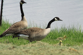
 The Flagstaff trails offer a variety of sights: birds, deer, squirrels, horned frogs, distant vistas and numerous trees. Old, broken oaks seem to end up looking the most interesting.


